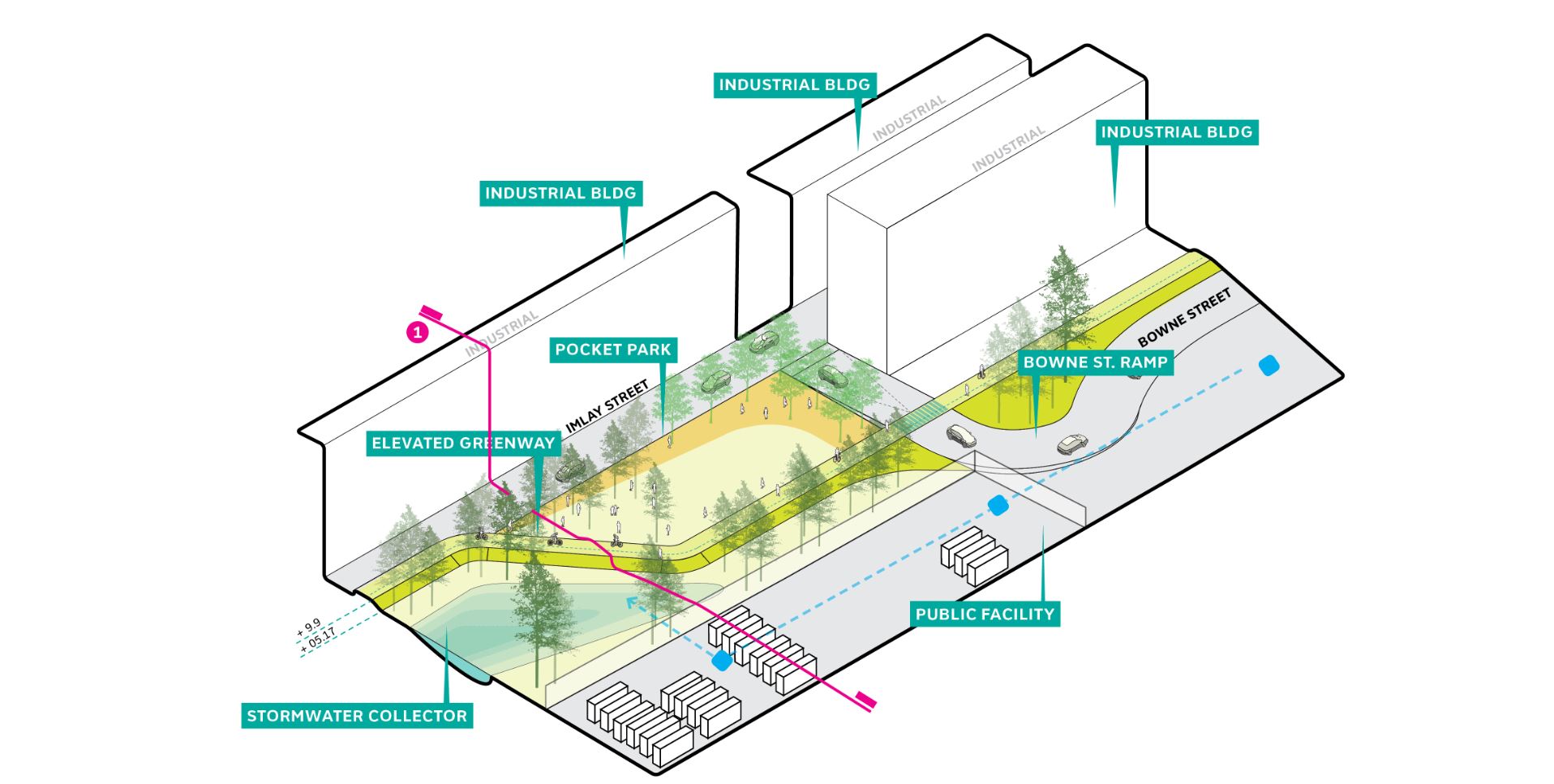
The Brooklyn Greenway Initiative has worked for over the last decade to champion a 26 mile route connecting Brooklyn’s waterfront. As part of the study, SCAPE was asked the question, “How can the Brooklyn Greenway serve as part of an integrated flood protection system in Red Hook?”
To answer this question, the team considered a 50-year flood event as the baseline for the study. The design strategy connects natural high points in the community; merging elevated flood protection with the future Greenway construction, raising portions of existing streets, and creating “soft” park like edges on either side. The proposal begins to push the notion of re-purposing existing city owned impermeable surfaces into public community spaces, which would provide opportunities for storm water detention. If realized, the Greenway would serve to protect residents and businesses within the floodplain, as well as offer an emergency access route in times of emergency.
Read more about the project here.