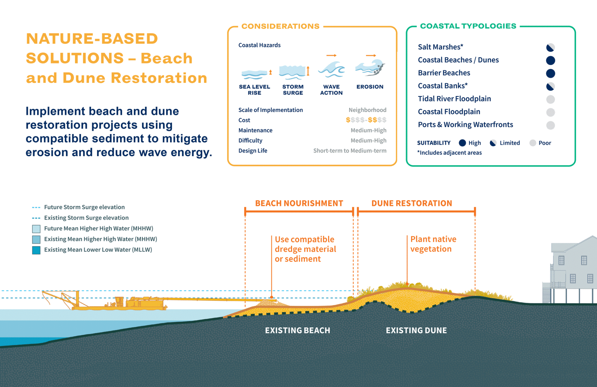
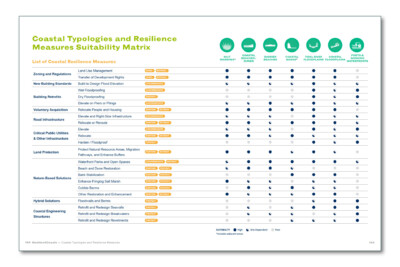
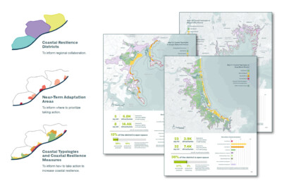
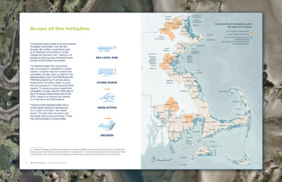
With over 1,500 miles of coastline, Massachusetts is highly vulnerable to coastal hazards. The ResilientCoasts Plan is a comprehensive, coastwide strategy that addresses significant threats such as sea level rise, storm surge, and erosion. This 50-year plan provides guidance and strategies to address near- and long-term vulnerability across the coast, identifying numerous potential resilience measures, ranging from site and building-level adaptations to community and regional-scale interventions, such as land use management tools, zoning regulations, proactive buyouts, nature-based solutions, and flood barriers, coded by suitability to various typical coastal environments. The plan overlays a series of risk and environmental factors to define Coastal Resilience Districts, and analyzed risk exposure across three sectors to identify Near-Term Adaptation Areas to guide immediate action.
SCAPE, as part of the team led by Woods Hole Group, collaborated with CZM to bring a landscape-forward approach to coastal resilience, using strategies that align with the dynamic coastal environments of Massachusetts. SCAPE developed an approachable planning framework and an overarching visual communications strategy, along with accessible and compelling materials for outreach and engagement: district maps, illustrations of coastal resilience measures, bird’s-eye views of typological coastal environments, explanatory diagrams, and data visualizations. Spanning salt marshes, barrier beaches, urban waterfronts, and working waterfronts, the plan stitches together a unified vision across the Cape Cod, North Shore, South Shore, and Islands coastlines.
Learn more:
- Learn more on the Massachusetts Office of Coastal Zone Management (CZM)’s website
- View the full plan here
- View the executive summary here
Client
- Massachusetts Energy and Environmental Affairs (EEA)
- Massachusetts Office of Coastal Zone Management (CZM)
Collaborators
Woods Hole Group
Consensus Building Institute
Industrial Economics